In this chapter, we try to do some off-roading in a land made of off-road roads and it turns out to be harder than one may think! On the other hand, our path crossed with that of a bear's.
Choosing where we want to go and what we want to see was not a piece of cake. We thought of going through Romania, Hungary and Austria, but we decided on a shorter option and more time to spent exploring without a car.
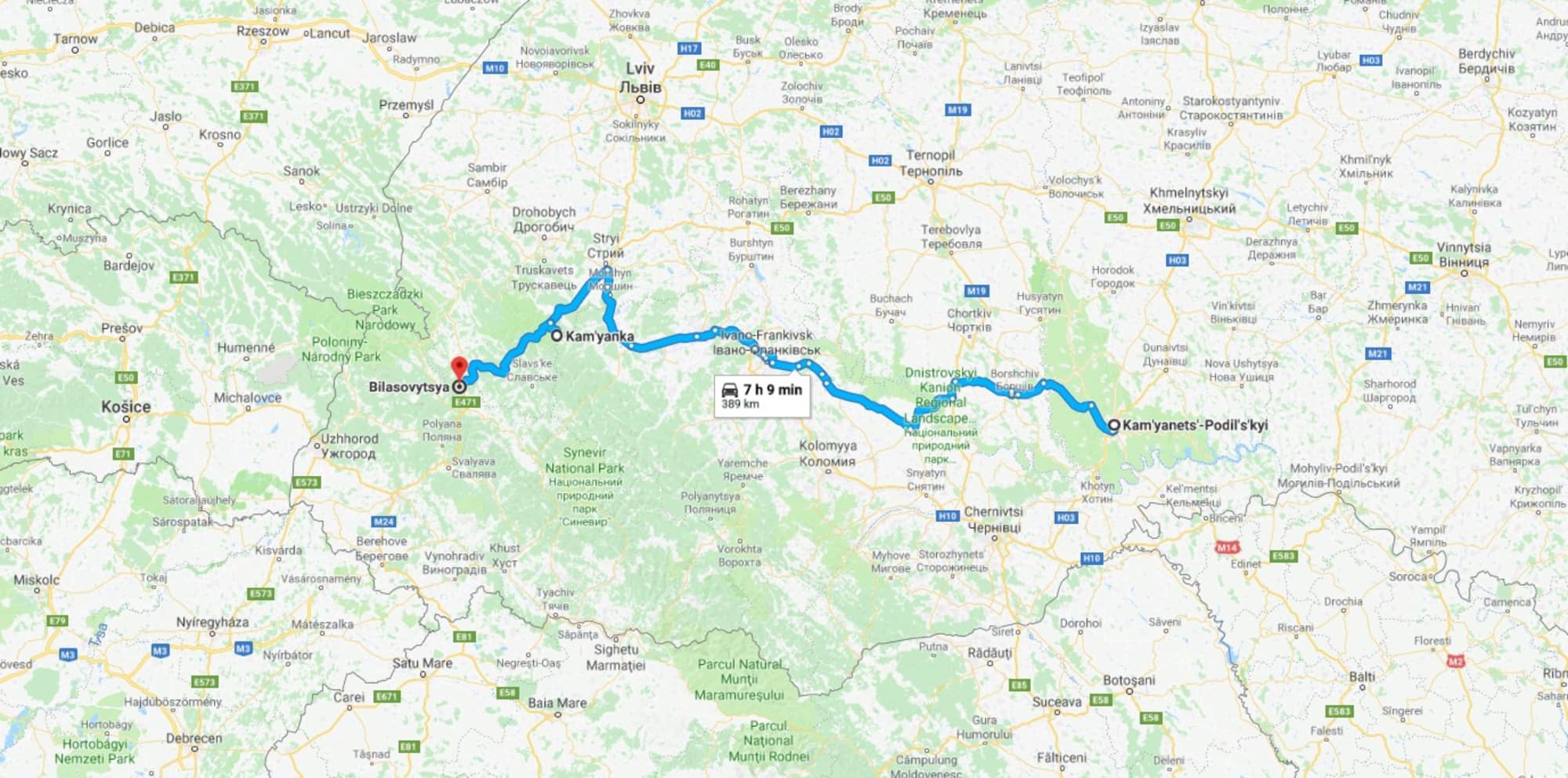
Having opted for staying in Ukraine, we still had a couple of options and a choice to make. The way further south through the Carpathians (and we were already southish) is definitely more beautiful: Driving through the mountains is always nice but it usually takes more time.
So we opted for the shorter and less spectacular road (possibly a bad choice!): driving along the Carpathians to the north and then just driving shortly into the mountains. The Carpathians are also less high there.
But it was not as short a drive as we had expected. It felt like it took us 3 hours to drive 90km leaving Kamyanets. After the whole day of driving we made only 287 km! We reached the mountains only shortly before it got dark.
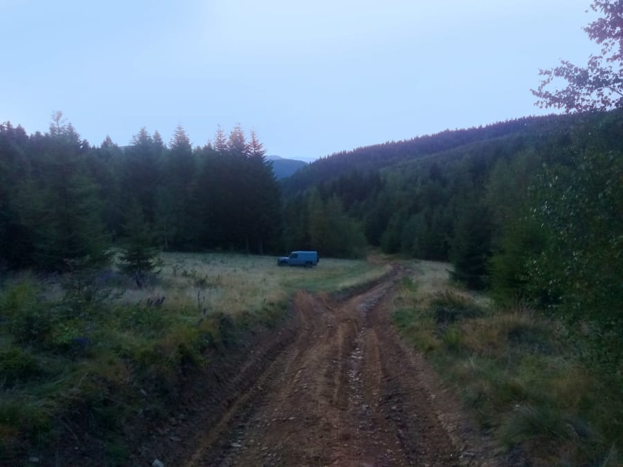
Passing the Kamenetsky waterfall we got to the pretty village of Kam'yanka, followed a road further up and threw the anchor just behind a river. Our Gnu allowed us to explore further up the steep muddy hill - we were looking for the ideal campsite, but it was way colder up in the mountains, the forest closed down the view and last but not least we saw the tracks of a big bear on the road. So we went back down to the river and maybe the best camping spot for the night remained undiscovered.
We had downloaded some maps with off-road trails in the Carpathians from the wikiloc website and our plan was to check some of those that were sort of on our way: Bukovel - Korpachizna and Uzhok - Velykyy Verkh. However, the road from Ivano-Frankivsk to Korpachizna (a part of Bukovel - Kopachizna trek) that was supposed to be an off-road road didn't differ a lot from the rest of the Ukrainian highways. :) But the map didn't lie: it was not a regular one either.
The other trail was extreme at the opposite end: It was suitable only for tractors (We did, however, try to get onto the trail our own way: - from a village called Bilasovytsya)
So we once more decided to explore the country on horseback the next day – we had also tagged some stables on our map.
it is you who keeps our site running and helps us grow and bring you more stories from our trips and the local people we encounter. We believe that telling these stories brings the world closer together and is hence a way to make a positive change! Please support us with a small donation on the kofi platform. Even a small contribution makes a big difference!